Student work
Wayfinding

Multiple students
ARTS 310 (Graphic Design II) #junior #senior | 2019 | New York, USA
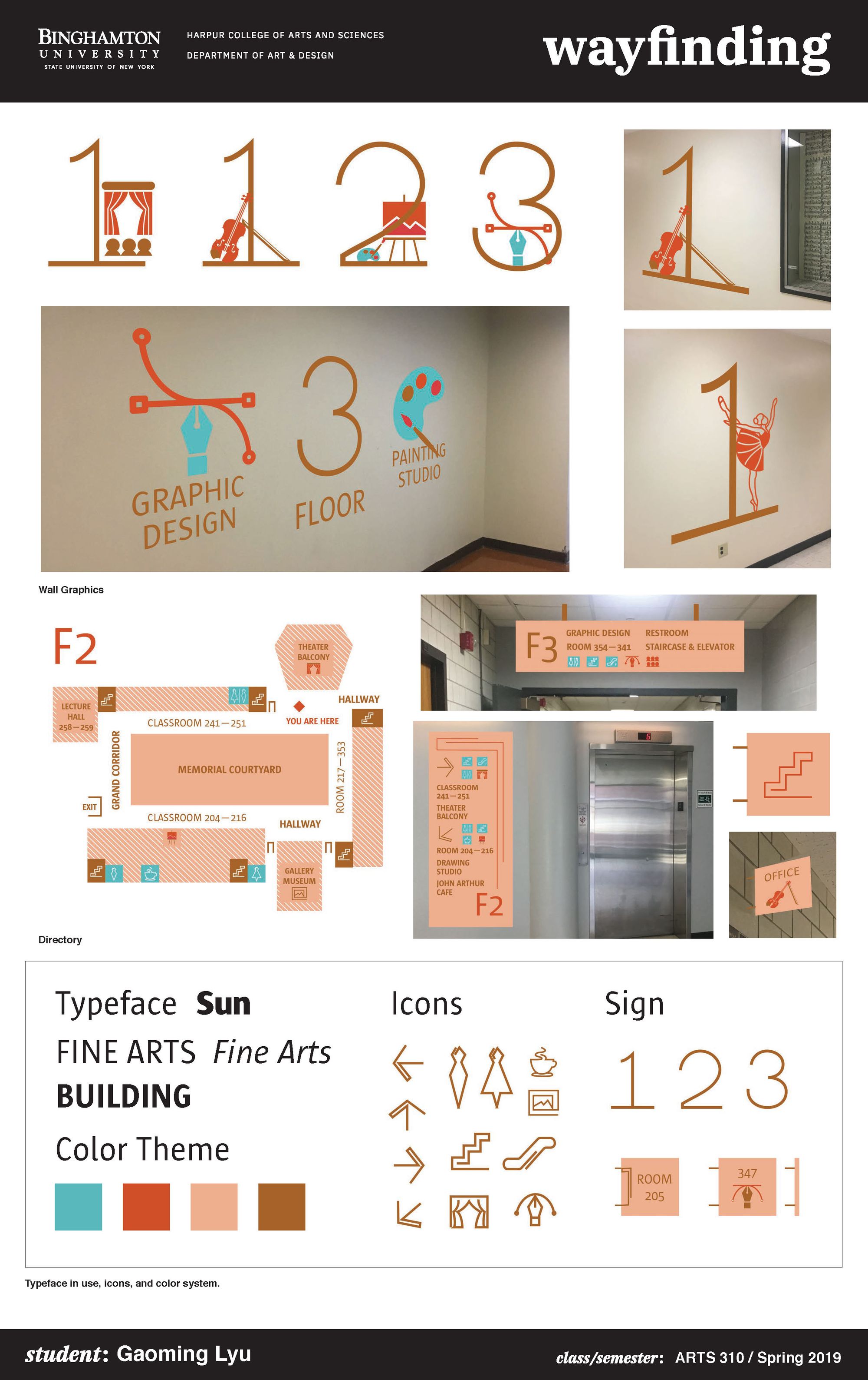
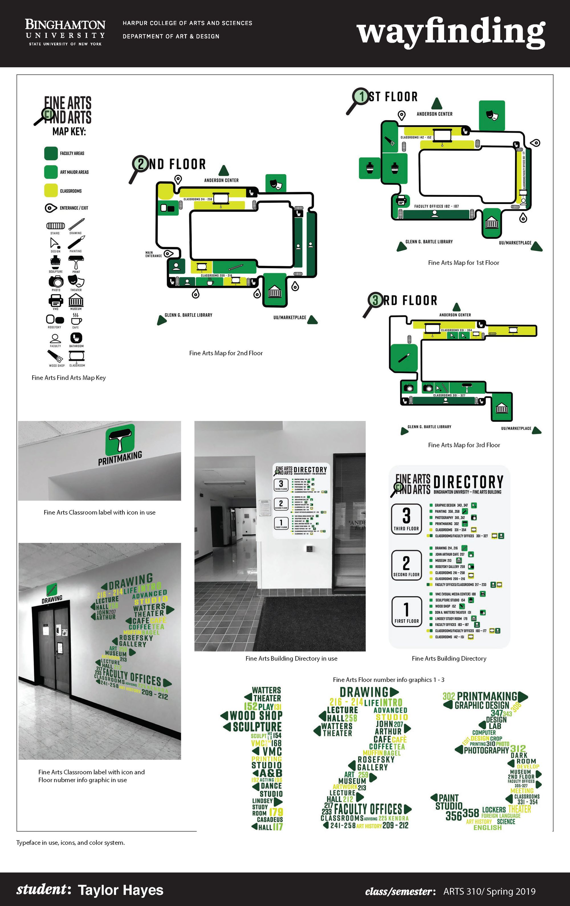
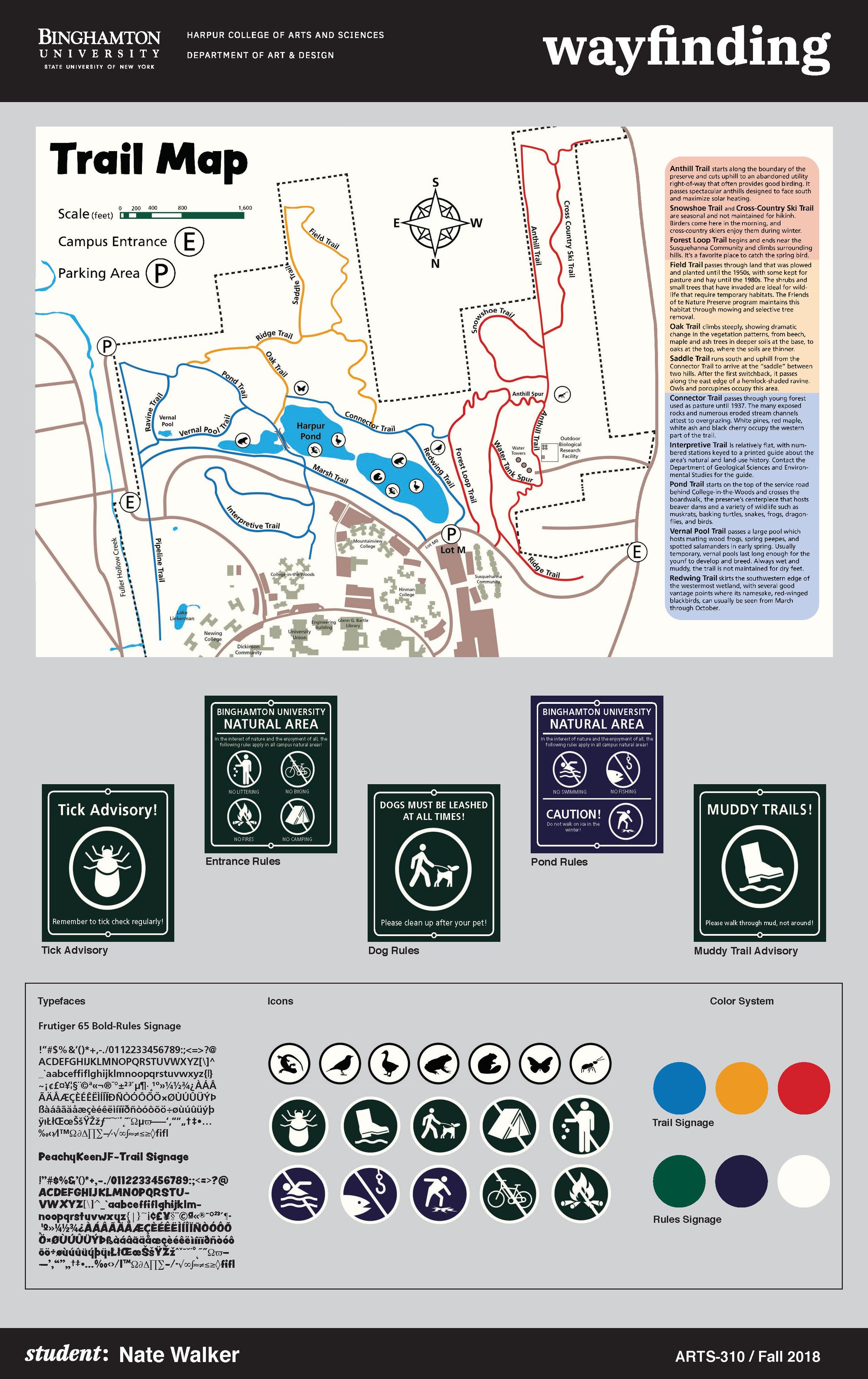
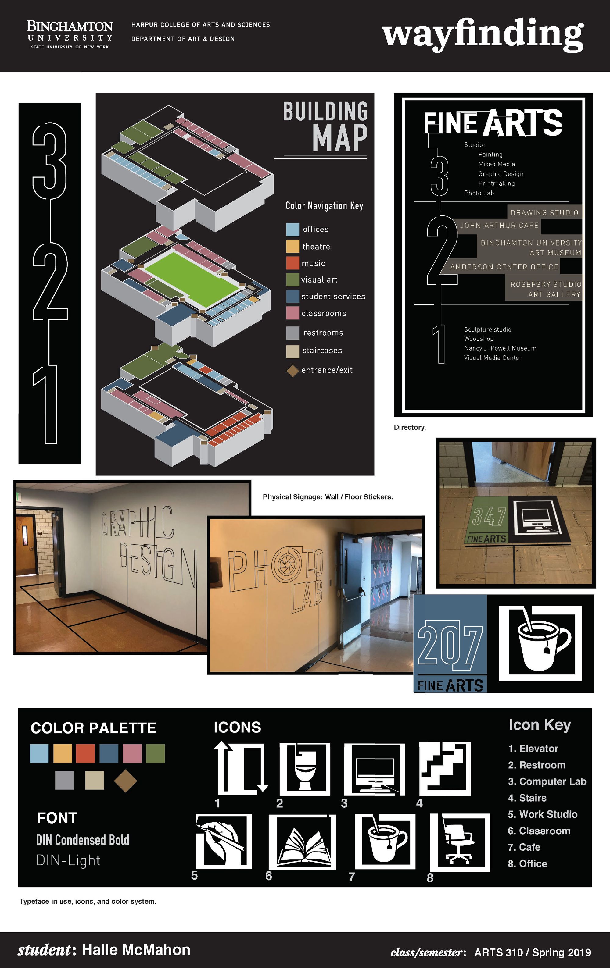
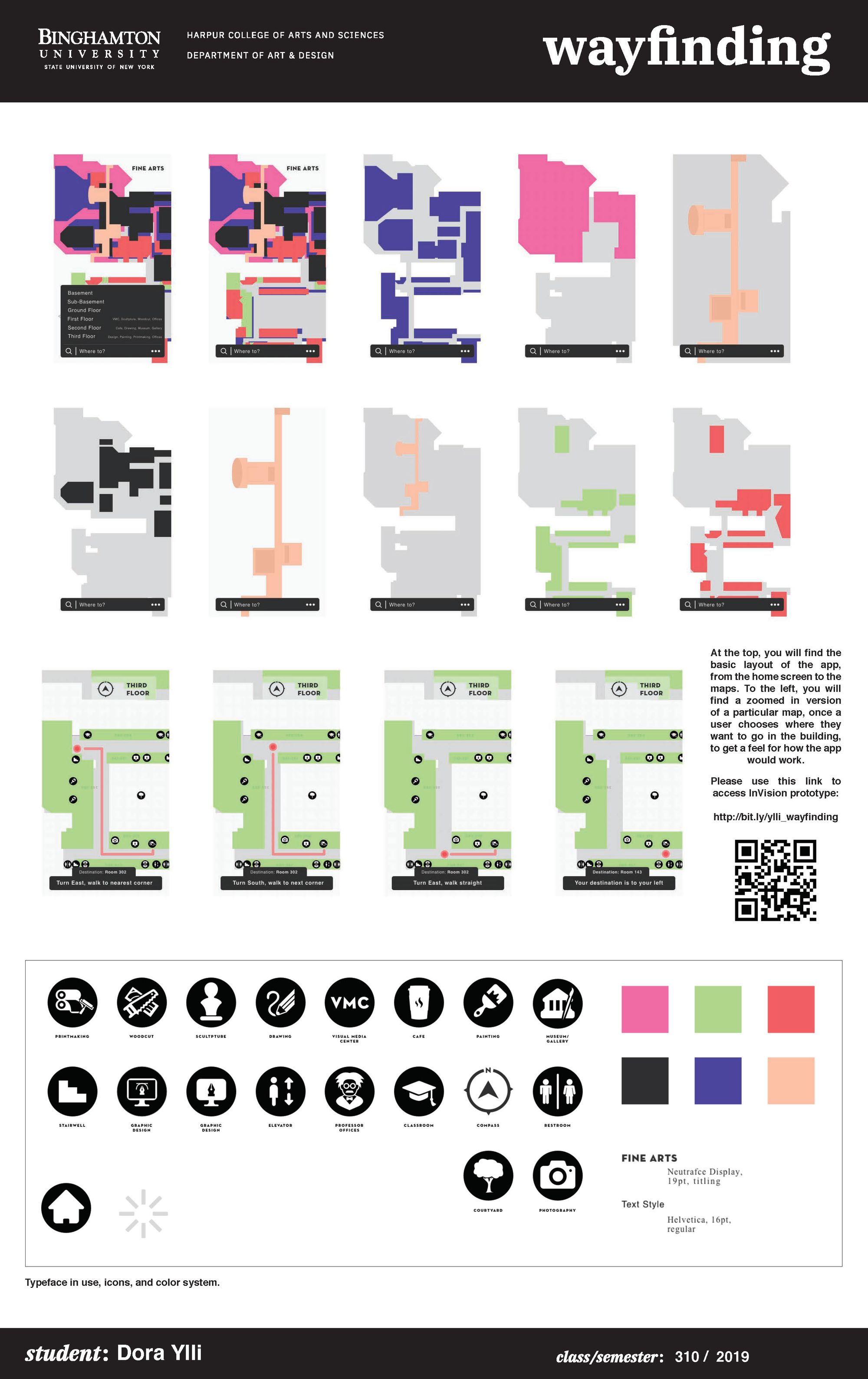
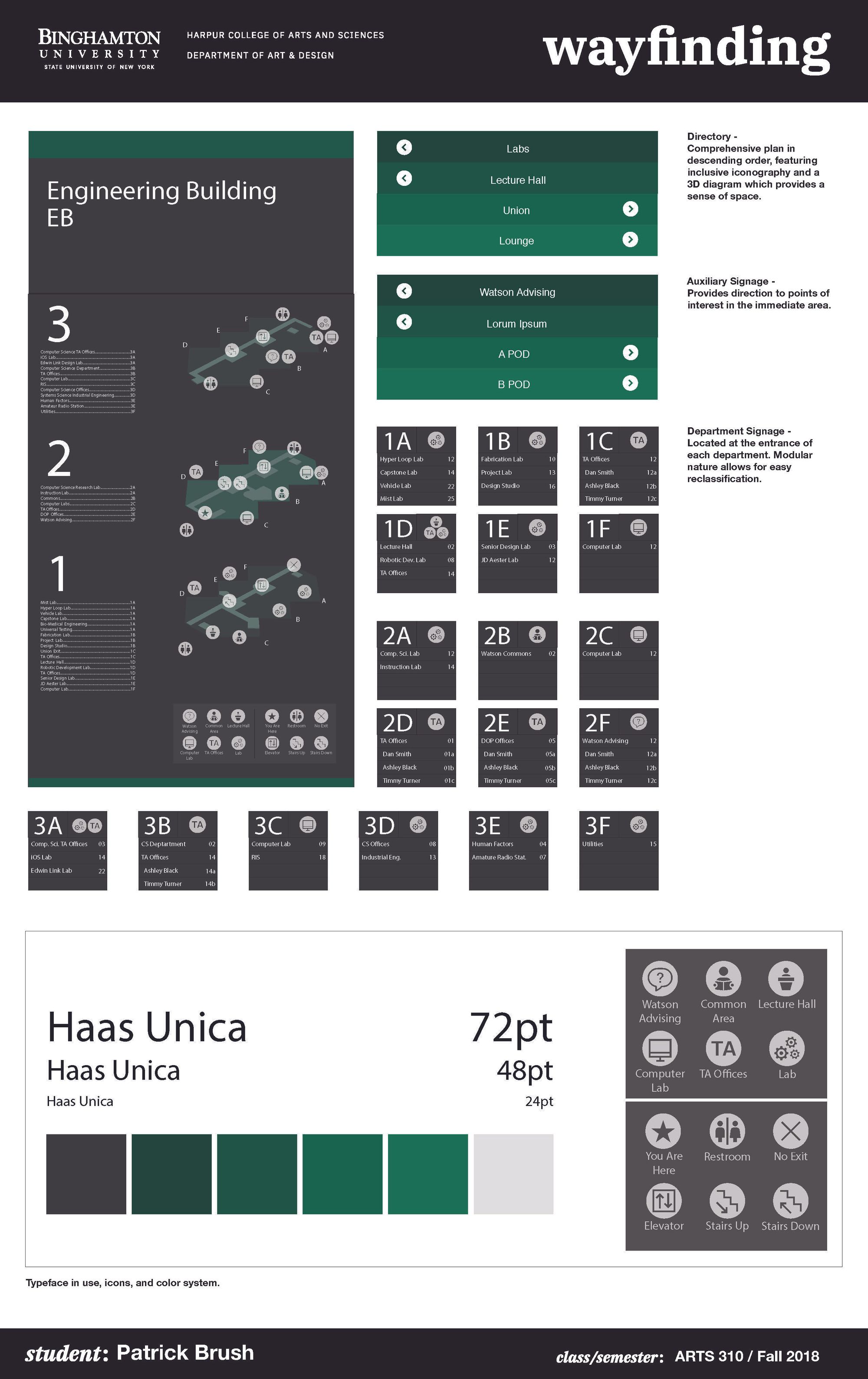
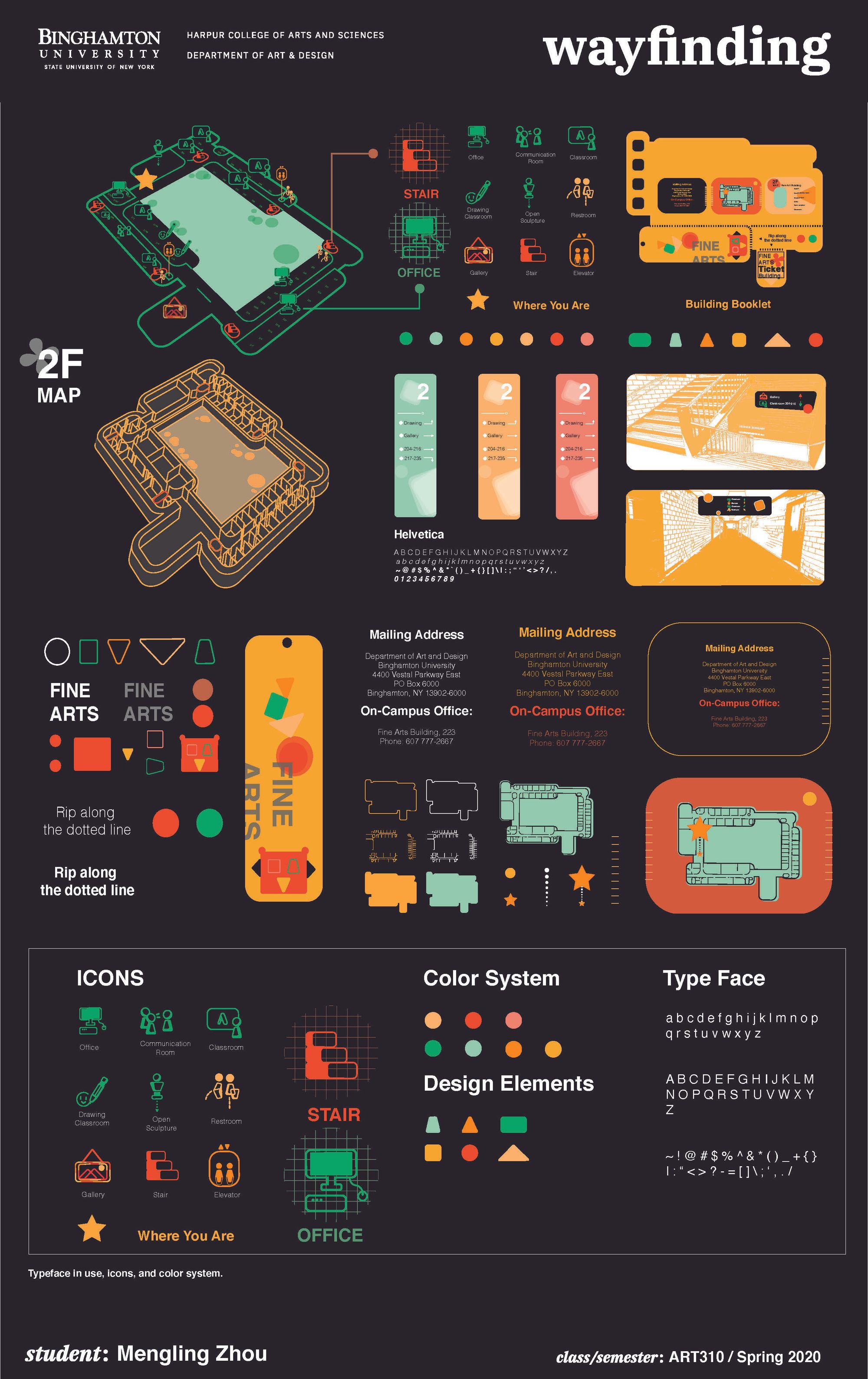
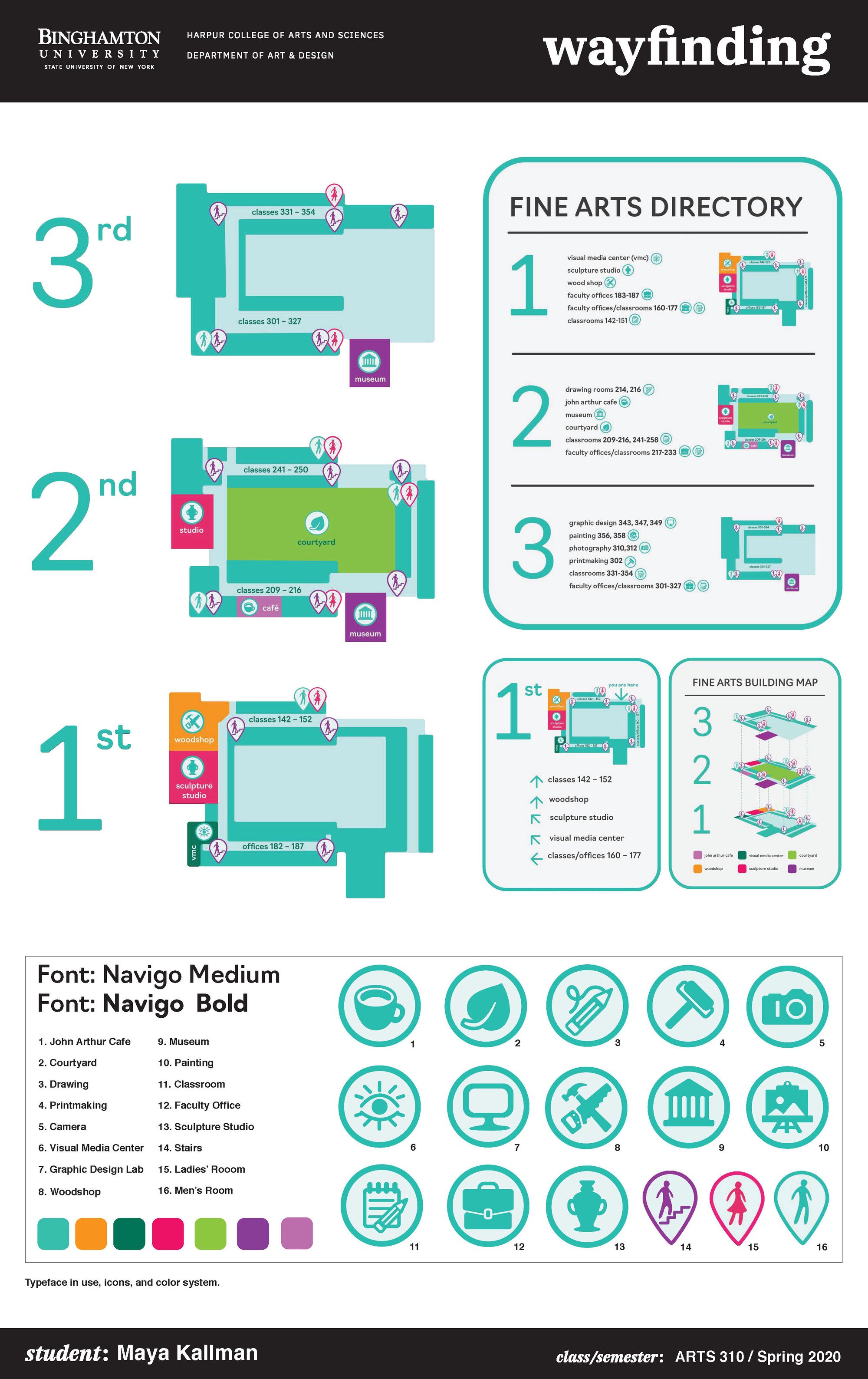
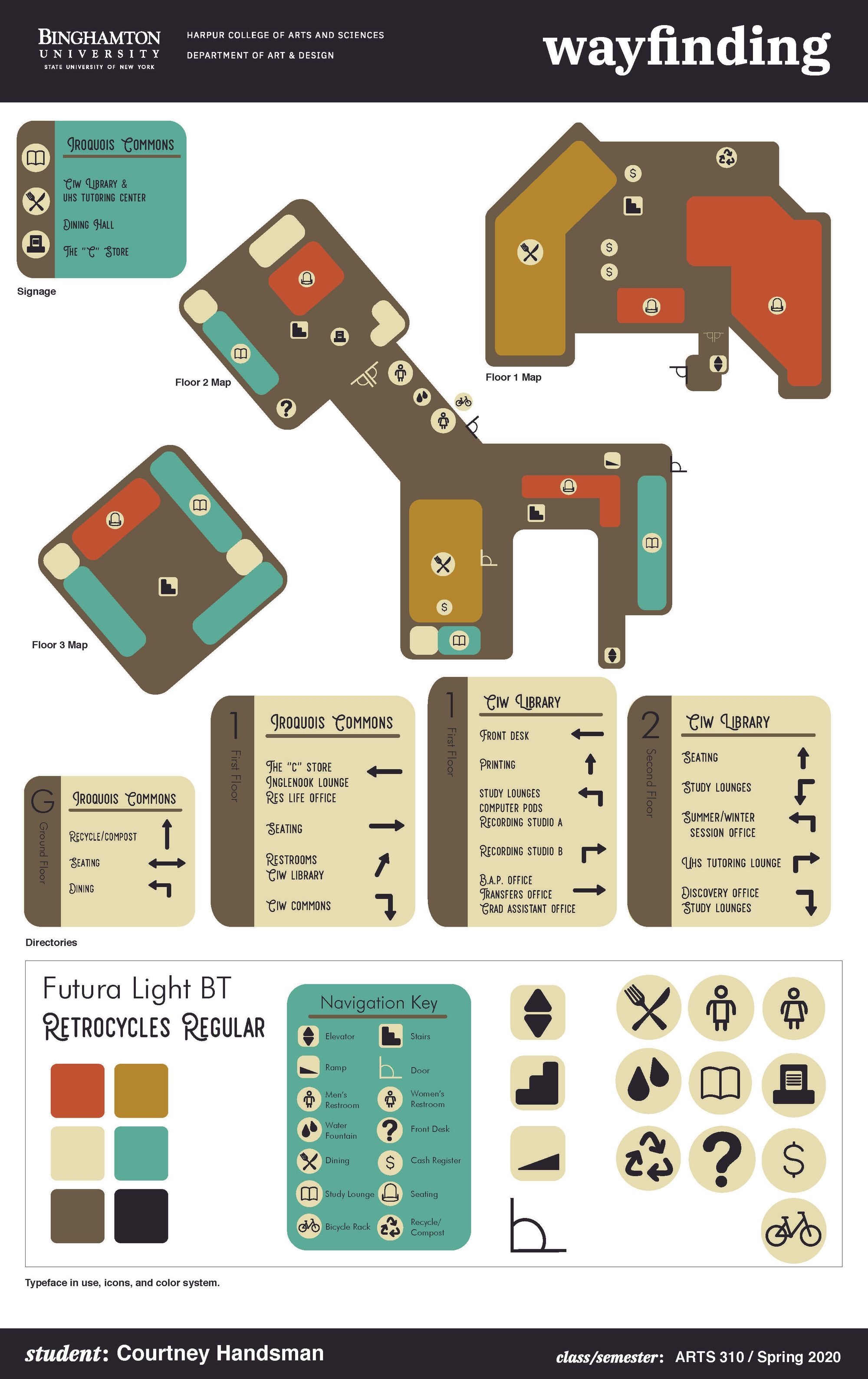
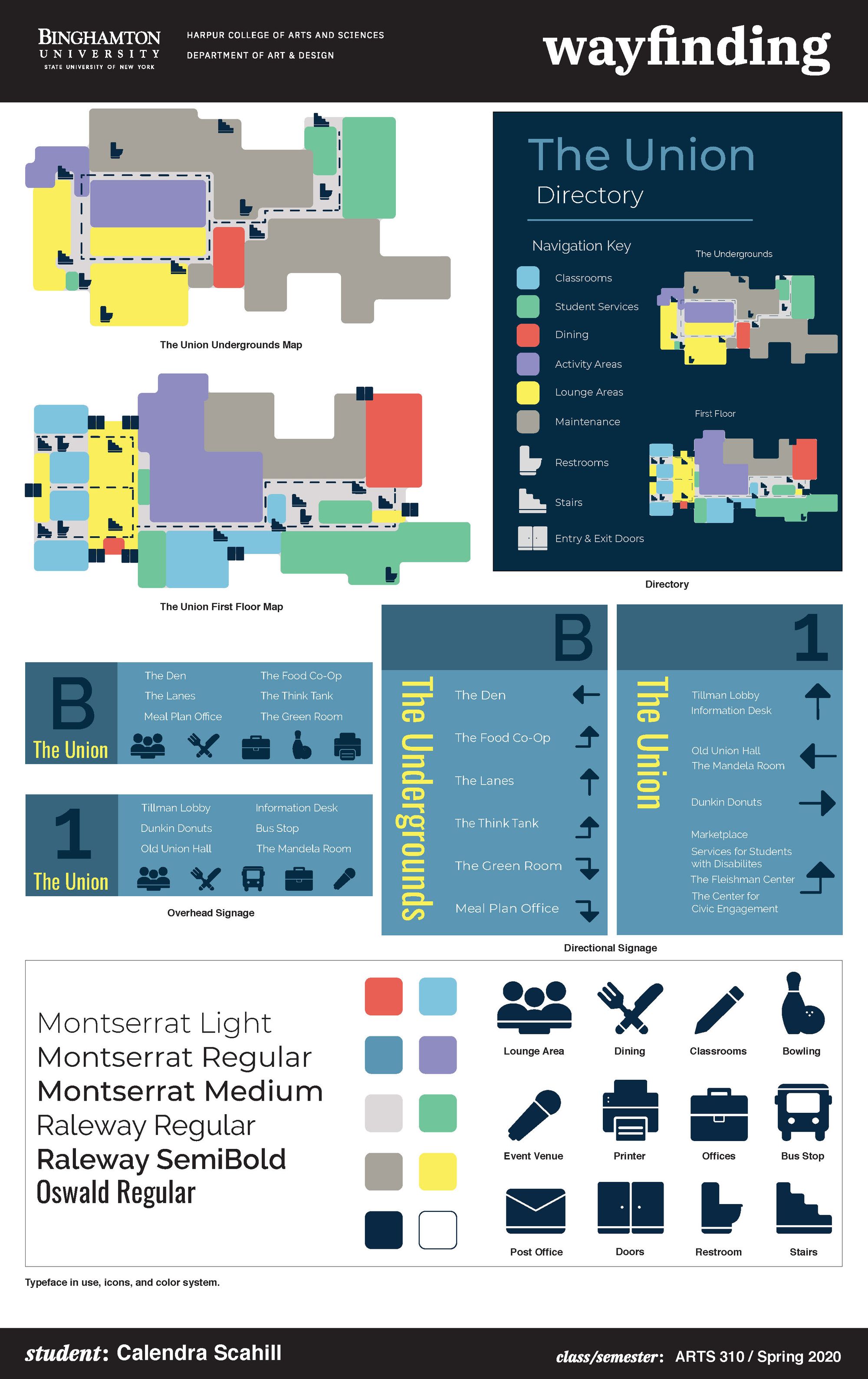
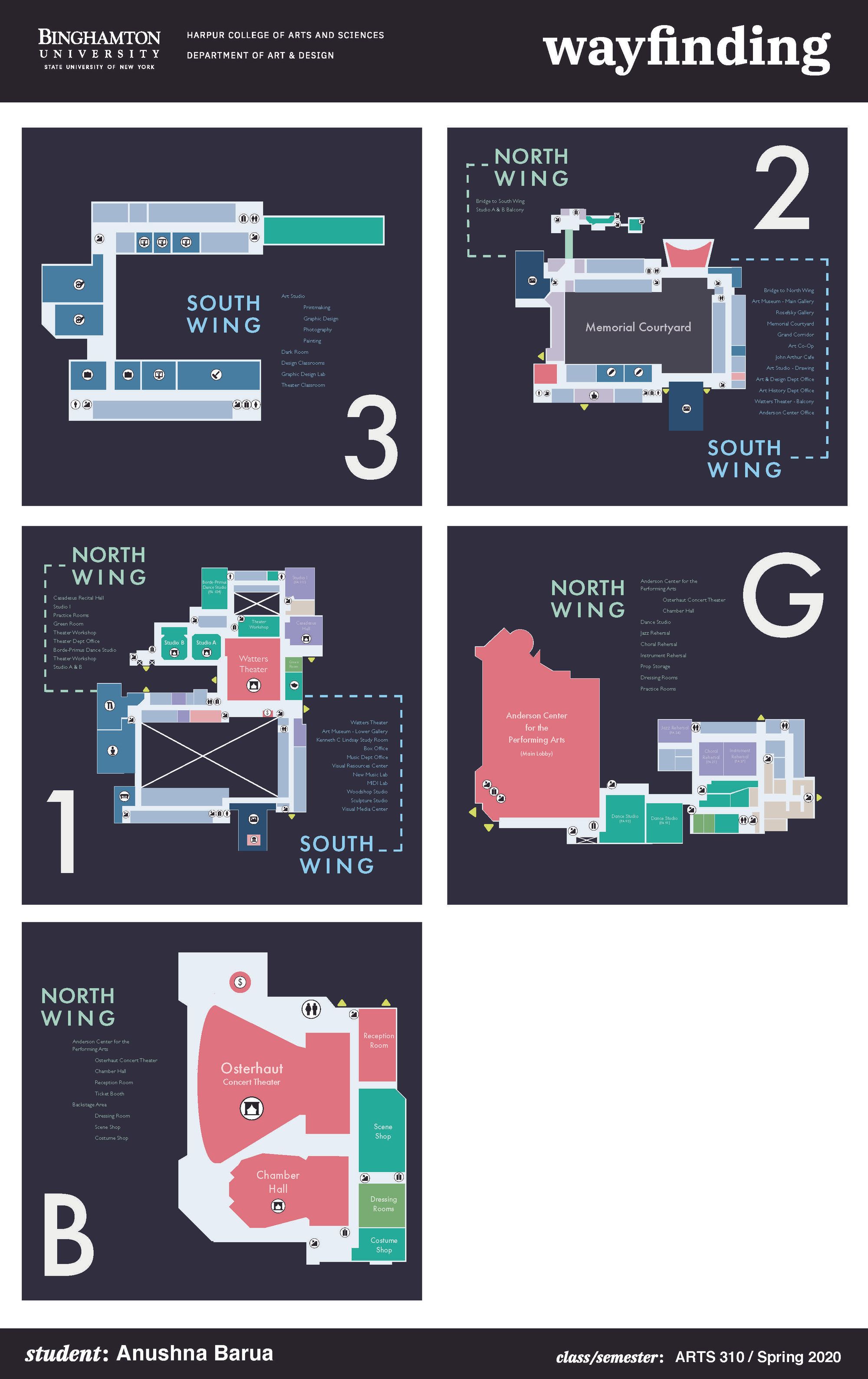
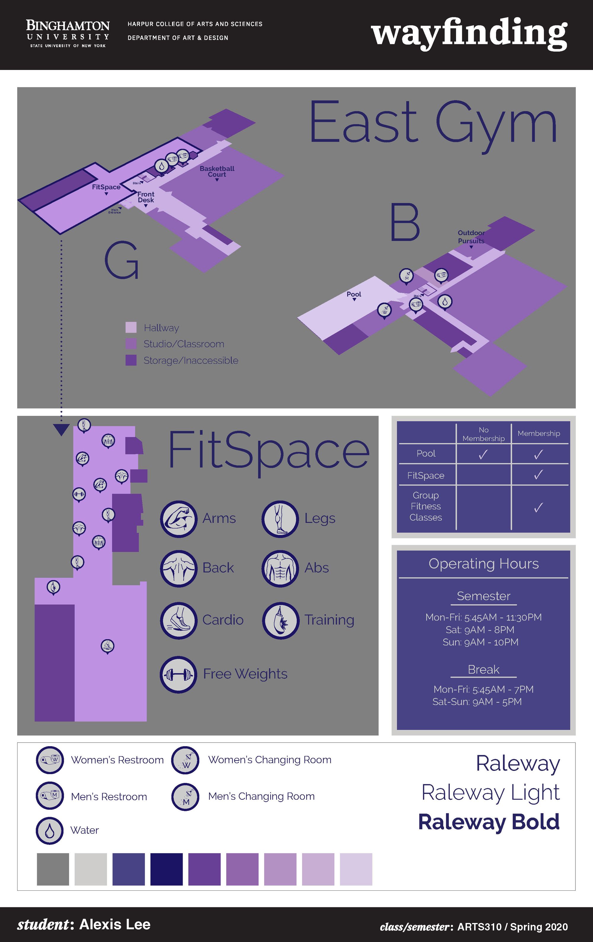
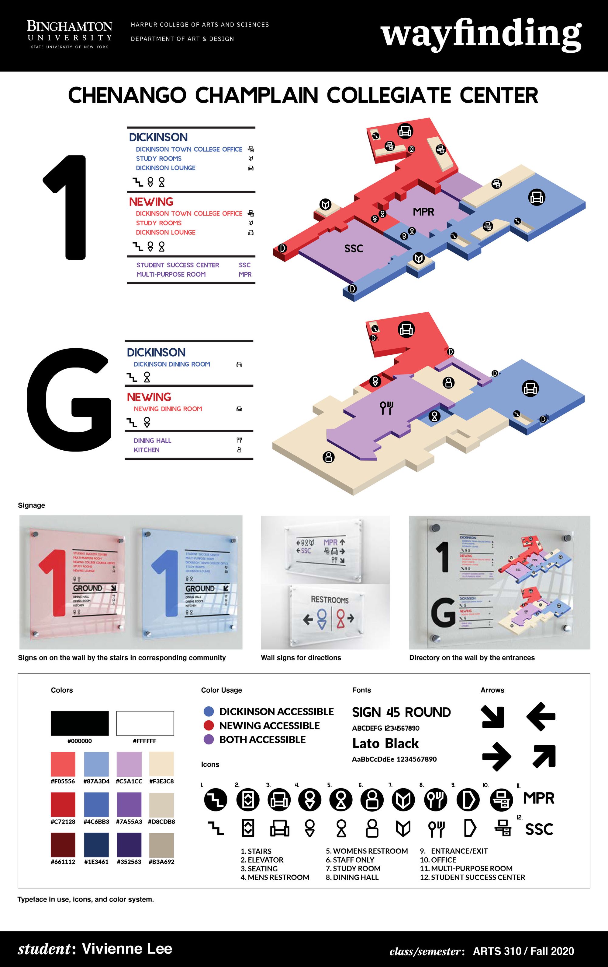
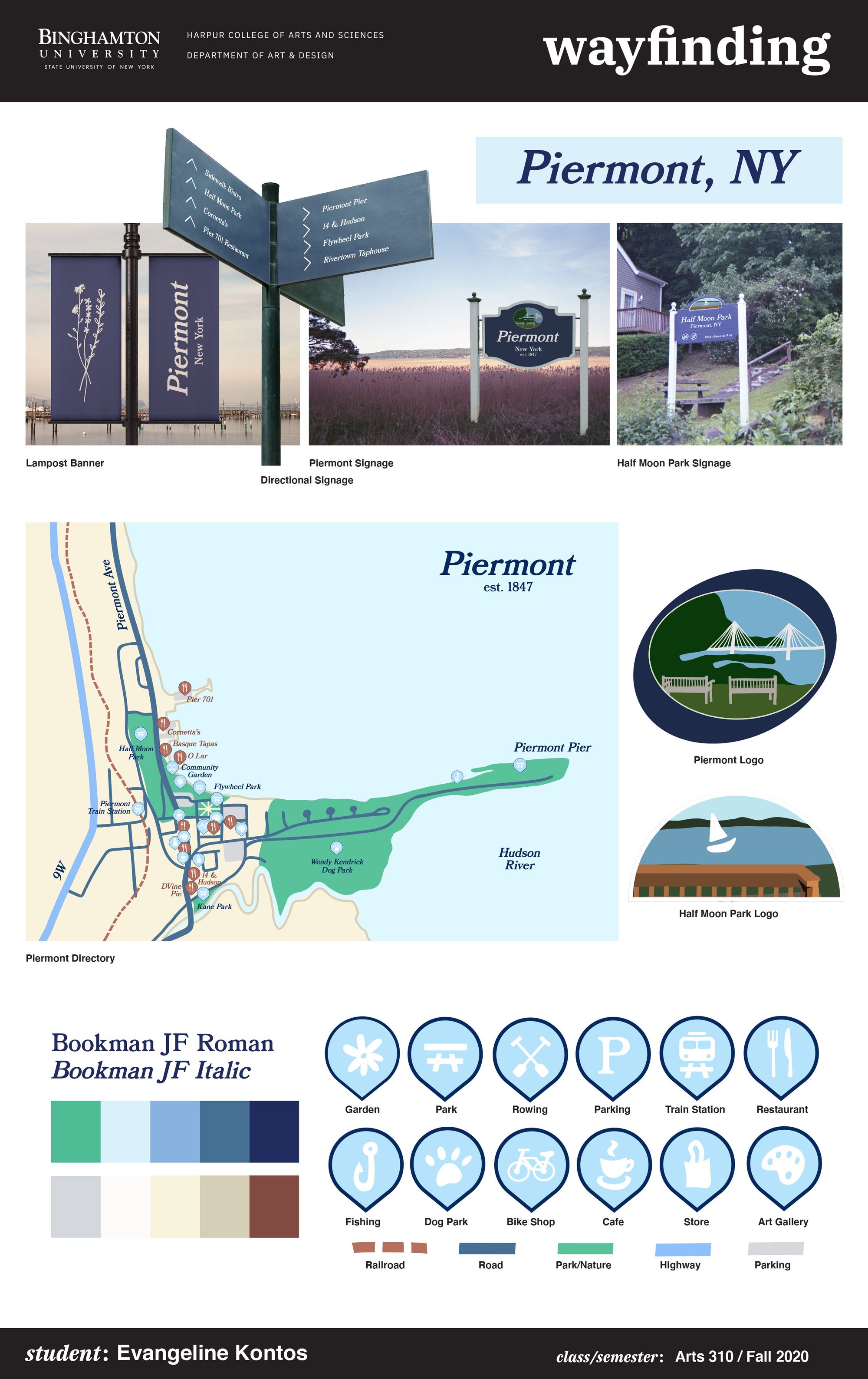
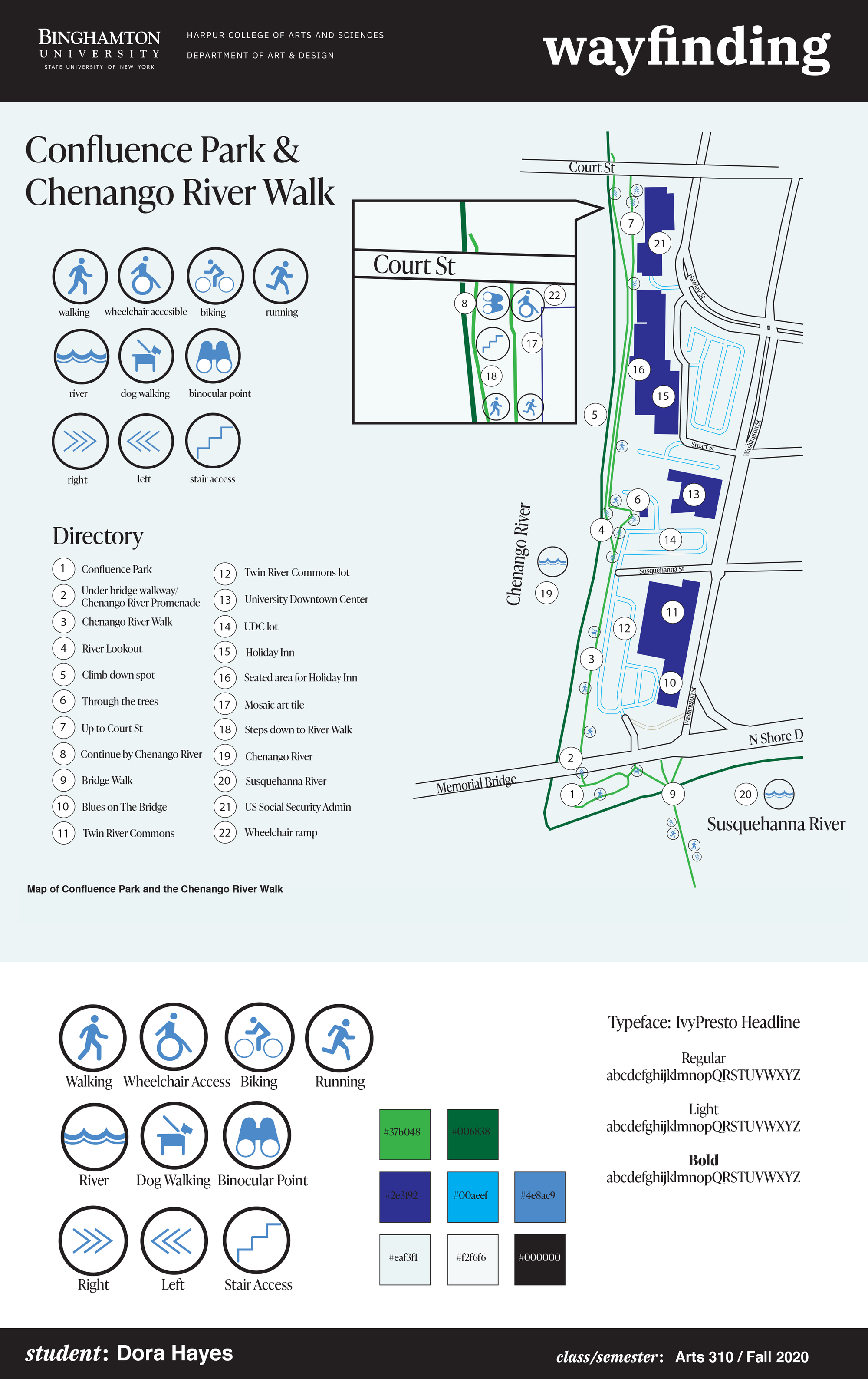
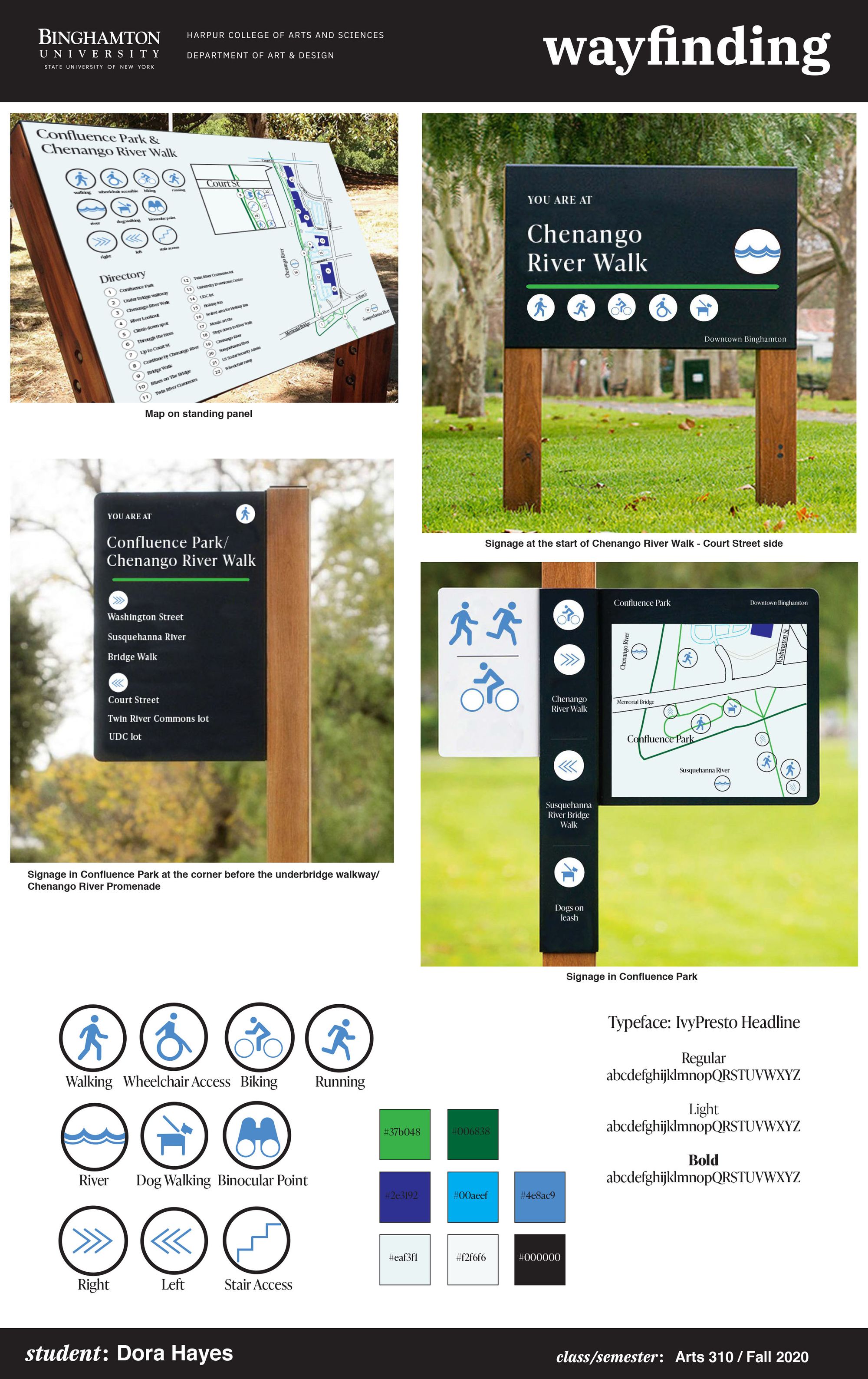
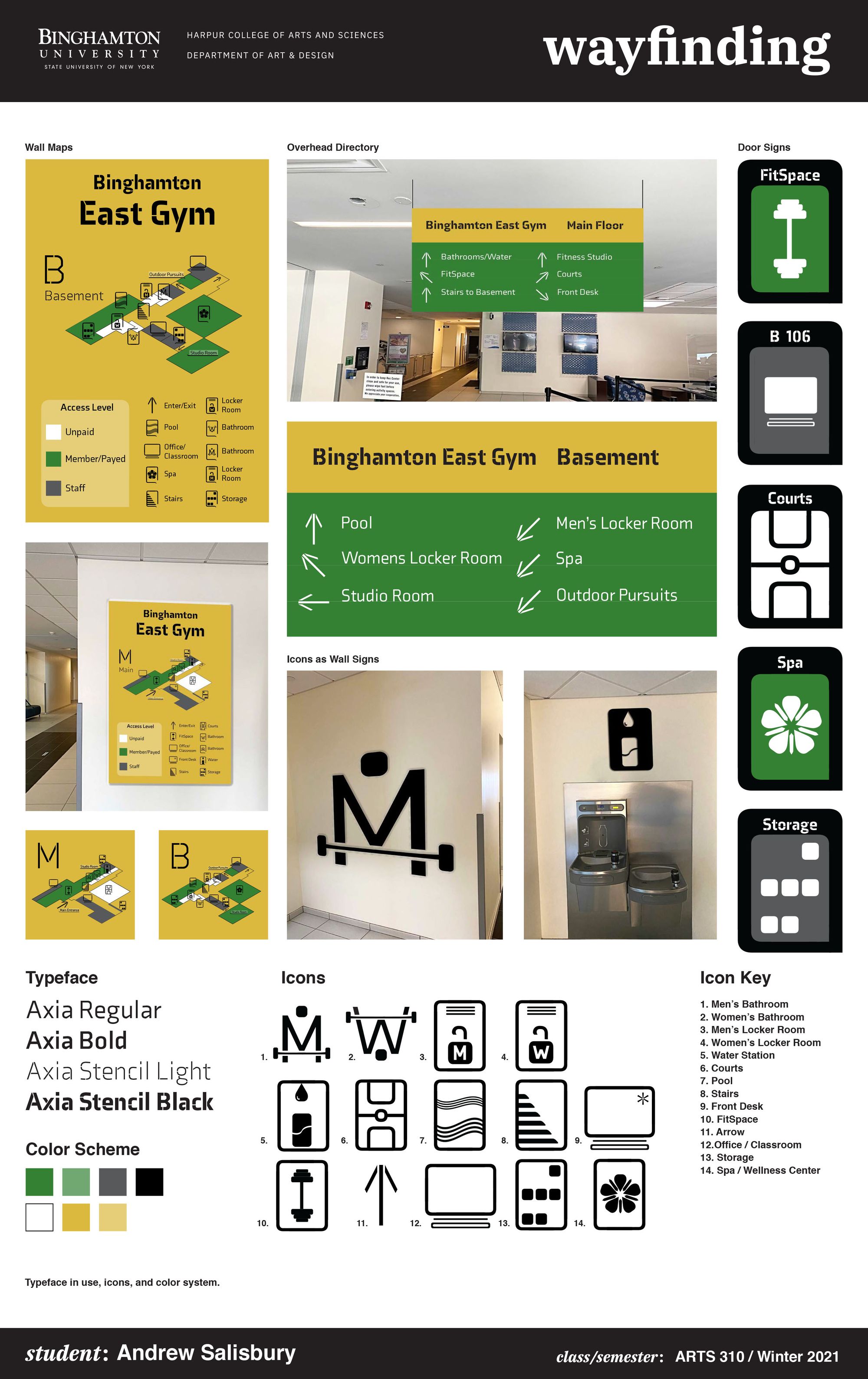
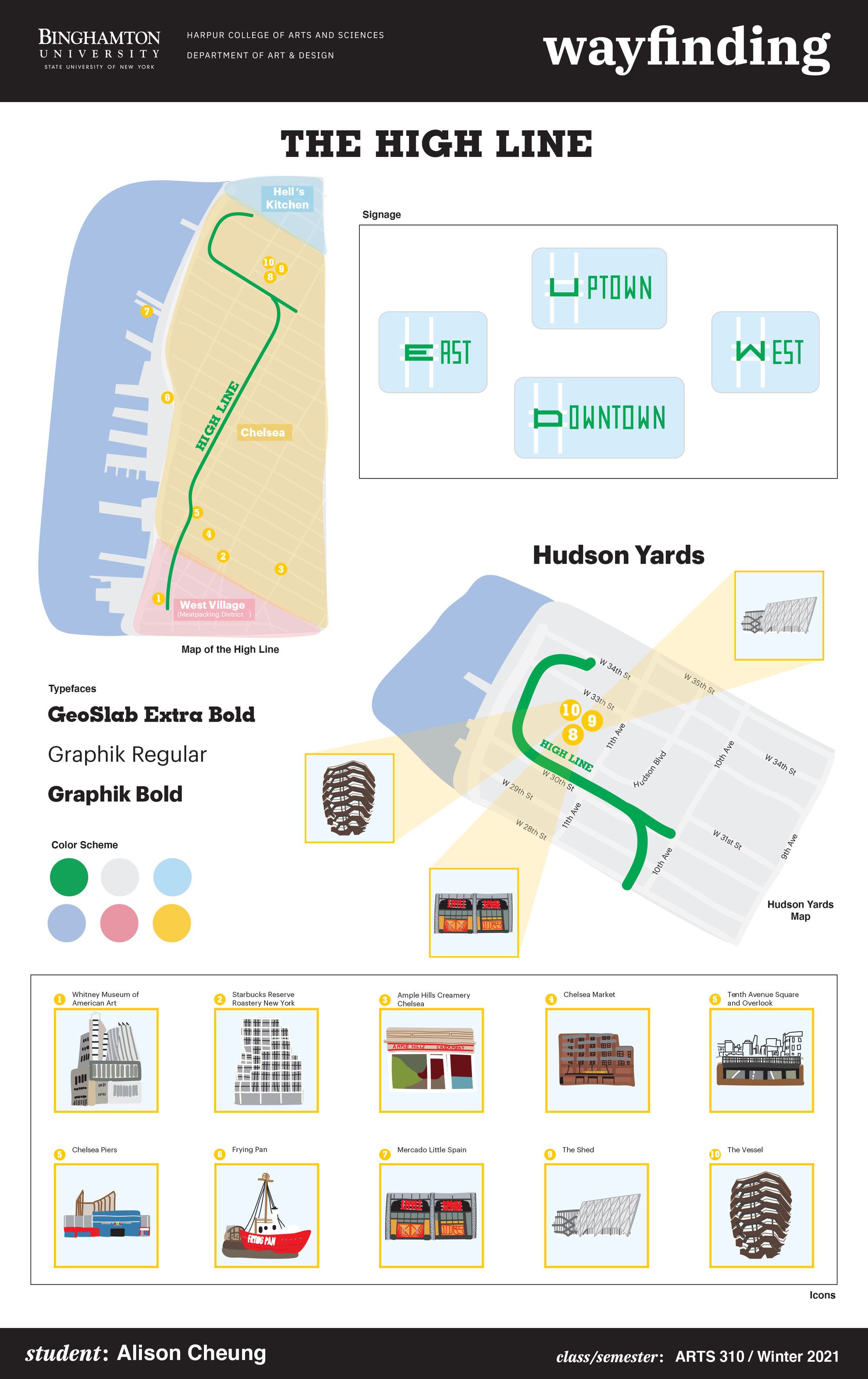
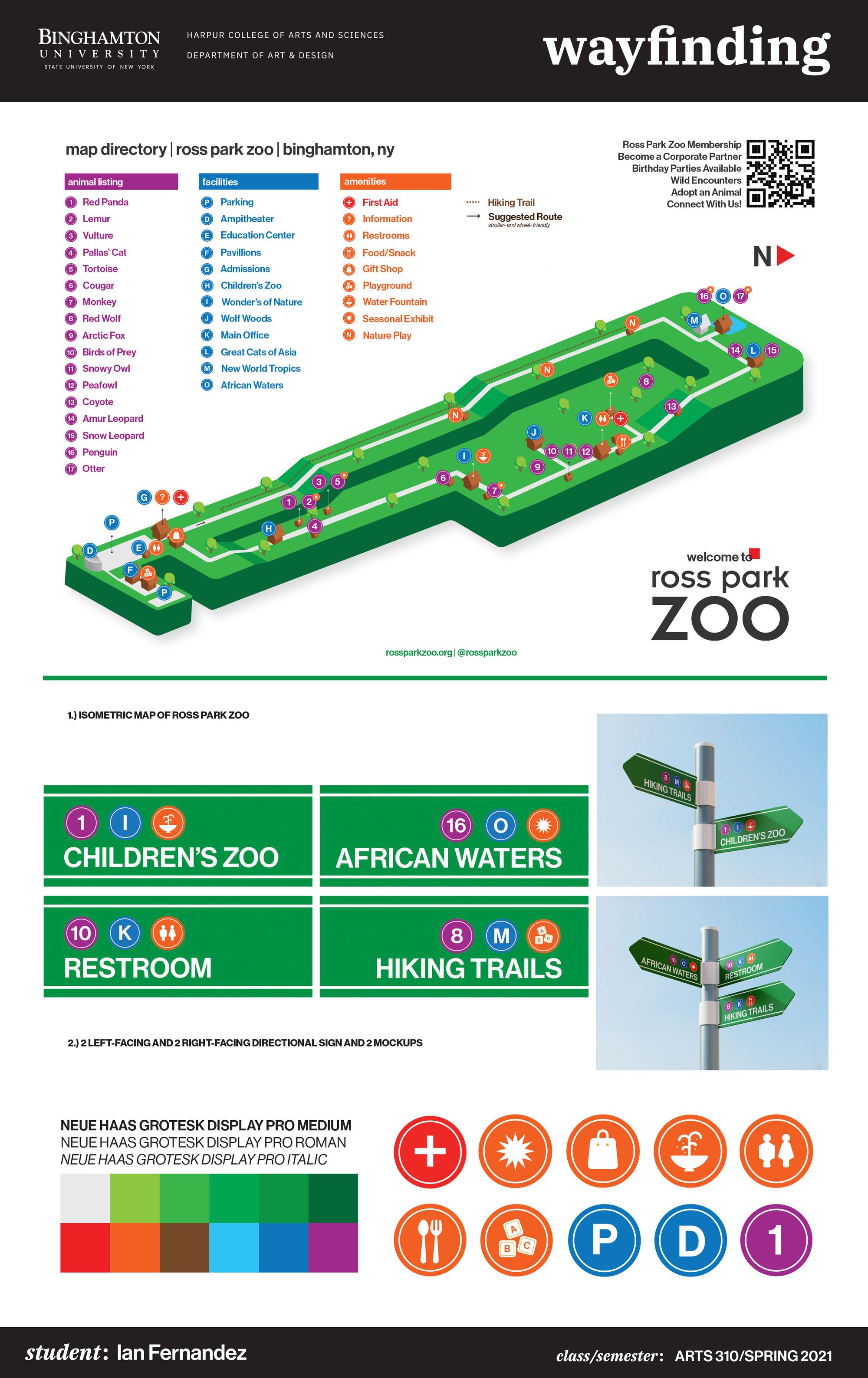
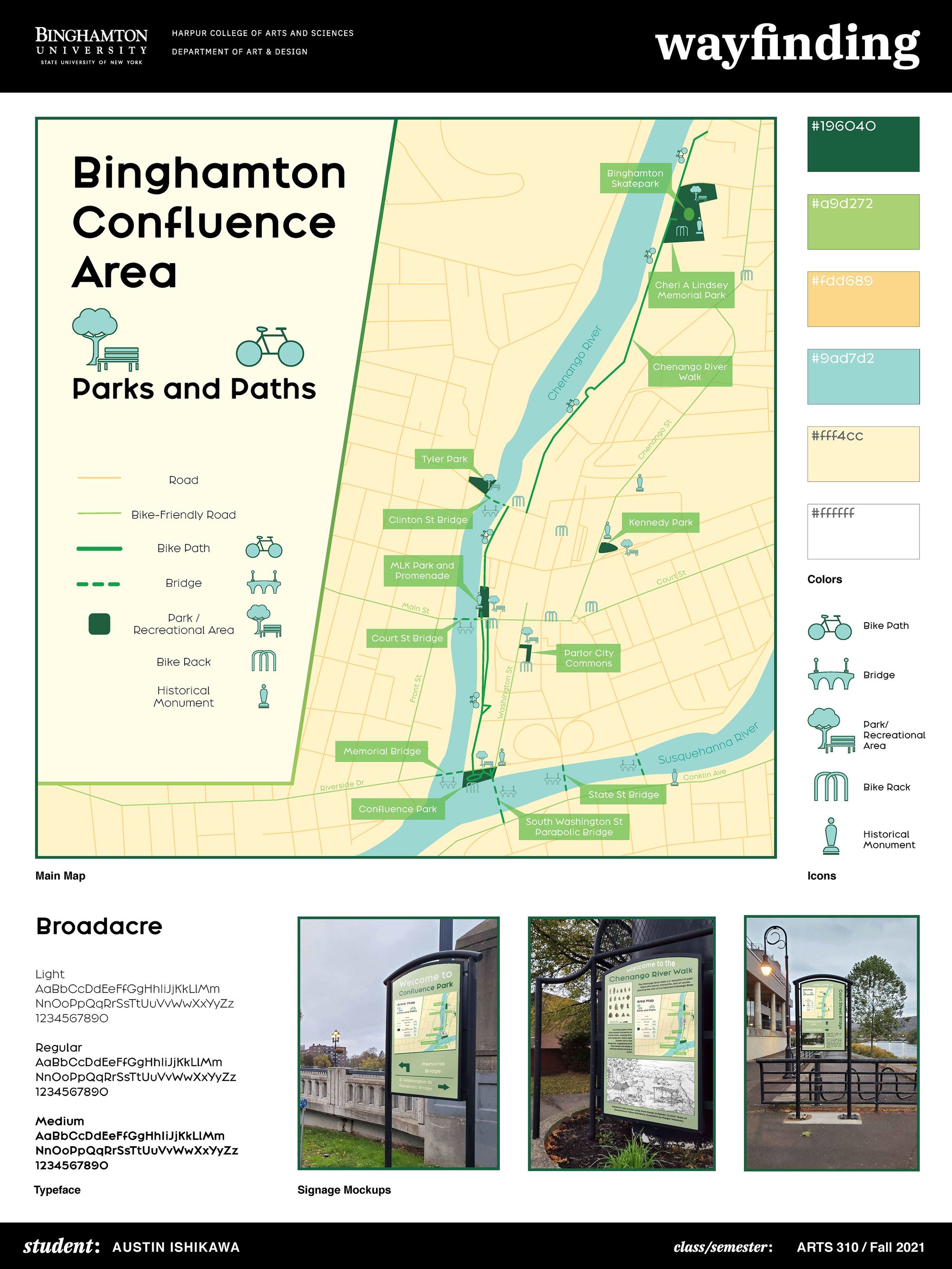
The task challenges students to work in the domain of environmental graphic design (EGD) to create a new wayfinding system for a large local public space, indoor or outdoor. Students will need to survey, review and study how the chosen space is used, and design a coherent, consistent and systematic typographic identity to support the navigation of the physical space. The starting point for the exercise is writing a taxonomy of the activities that happen in the space: a list of all relevant actions, circulation paths, decision points, rooms, etc. It is such plan that feeds the design of the map for the building or space, and for a flexible visual signage system that will include custom icons, ←→s, symbols, and a possible design/adaptation of a logo mark.
The idea for this exercise came to me while working on an EGD project in 2010, and because my colleague, Professor Hakan Ertep introduced me to David Gibson, Principal of the NYC based wayfinding firm Two Twelve. Gibson, his work, and his book The Wayfinding Handbook: Information Design for Public Places have been inspirational, and so this assignment is also a form of gratitude, to pass on to my students some important concepts about “showing the way.” The pedagogy involved in the research (design as research) is innovative and creative, particularly because, as David Gibson says, “the wayfinding designer’s work lies at the intersection of people and places.”
The term wayfinding, defined as “the act of finding one’s way to a particular place; navigation,” was added to the Oxford English Dictionary in 2015 by the signage systems design firm Endpoint. Practically, wayfinding is indeed “wayshowing” (like teaching is learning) and so to “show the way” for how to efficiently use a public indoor or outdoor place is the goal of the research activity I presented to my students.
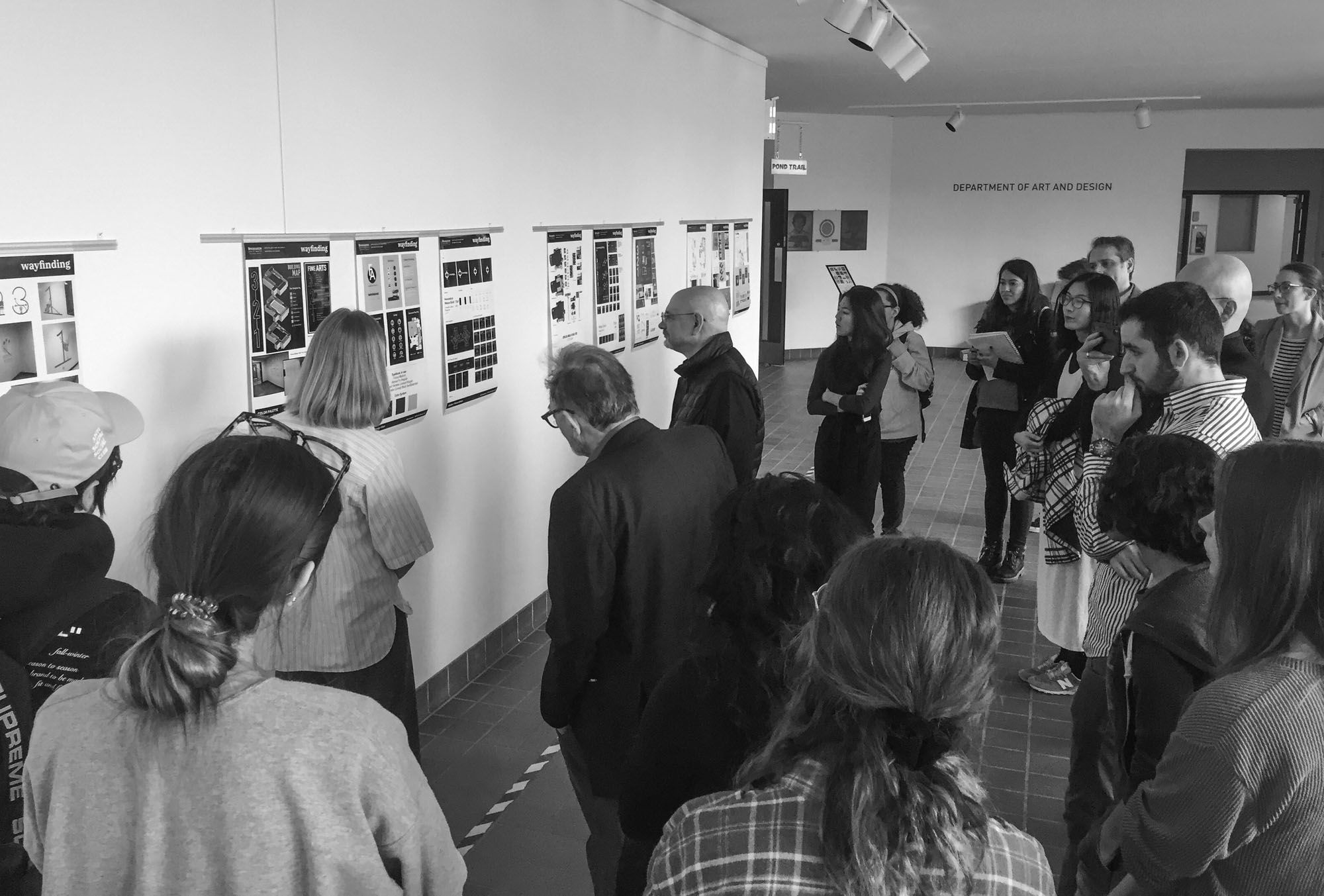
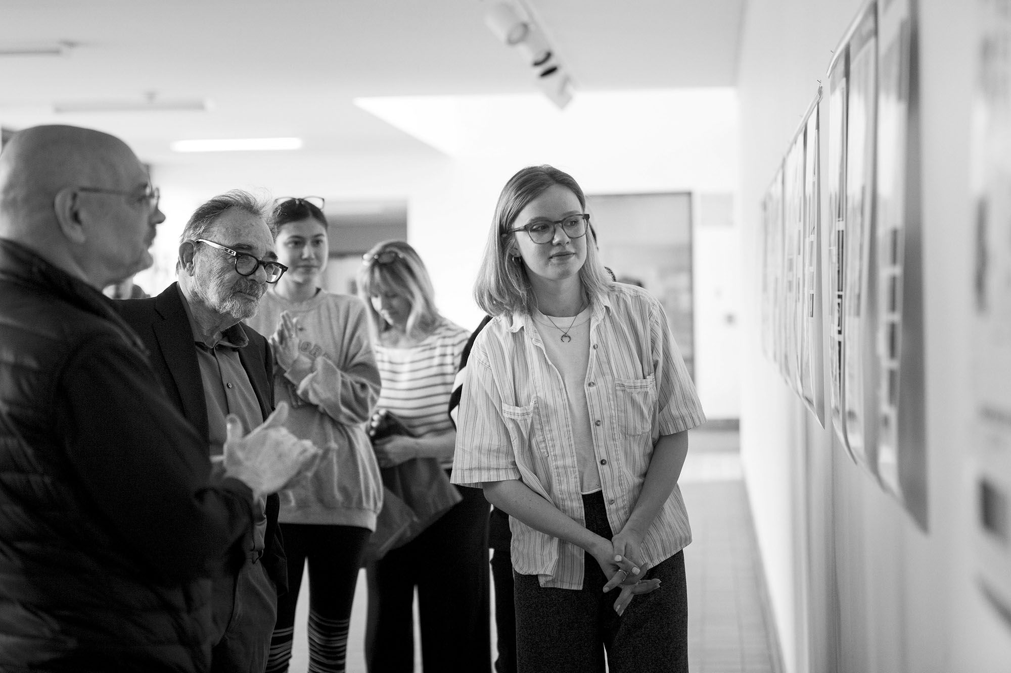
The outcomes from fall 2018 and spring 2019 at Binghamton University were exhibited in the Fine Arts building, and students had the opportunity to engaged in critique with special guests Seymour Chwast & Steven Heller (April, 2019).
In the spring 2021, the project ran in partnership with Phillip Ginter, Ross Park Zoo Executive Director. Eight of the 11 students and Andrew Salisbury, TA were able to visit the Zoo, and do research on location. Salisbury had been of great help in the process. The project and the teaching included design feedback sessions and two Zoom video meetings with Ginter, which were coordinated through a digital interactive Slack workspace, the digital classroom I set up. Together with Salisbury, we helped students apply their knowledge and creativity to a “real-world scenario” collective enterprise, done with and for people, seeking to make the Ross Park Zoo a memorable, interesting, and accessible place. I believe that the exercise with with the Zoo clearly shows the project potential for building community capacity through course partnerships, as a wayfinding system incorporates branding, signs, maps, and directional devices that tell us where we are, where we want to go, and how to get there. Graphic Design II is now designated by the University’s Center for Civic Engagement as a community-engaged learning course (CEL), which means the course meets nationally recognized standards that enhance student learning and deepen mutually beneficial university-community engagement. The project is published on Collaboratory, a publicly searchable online database of community engagement and service activities involving Binghamton University faculty, staff, students, and their community partners.
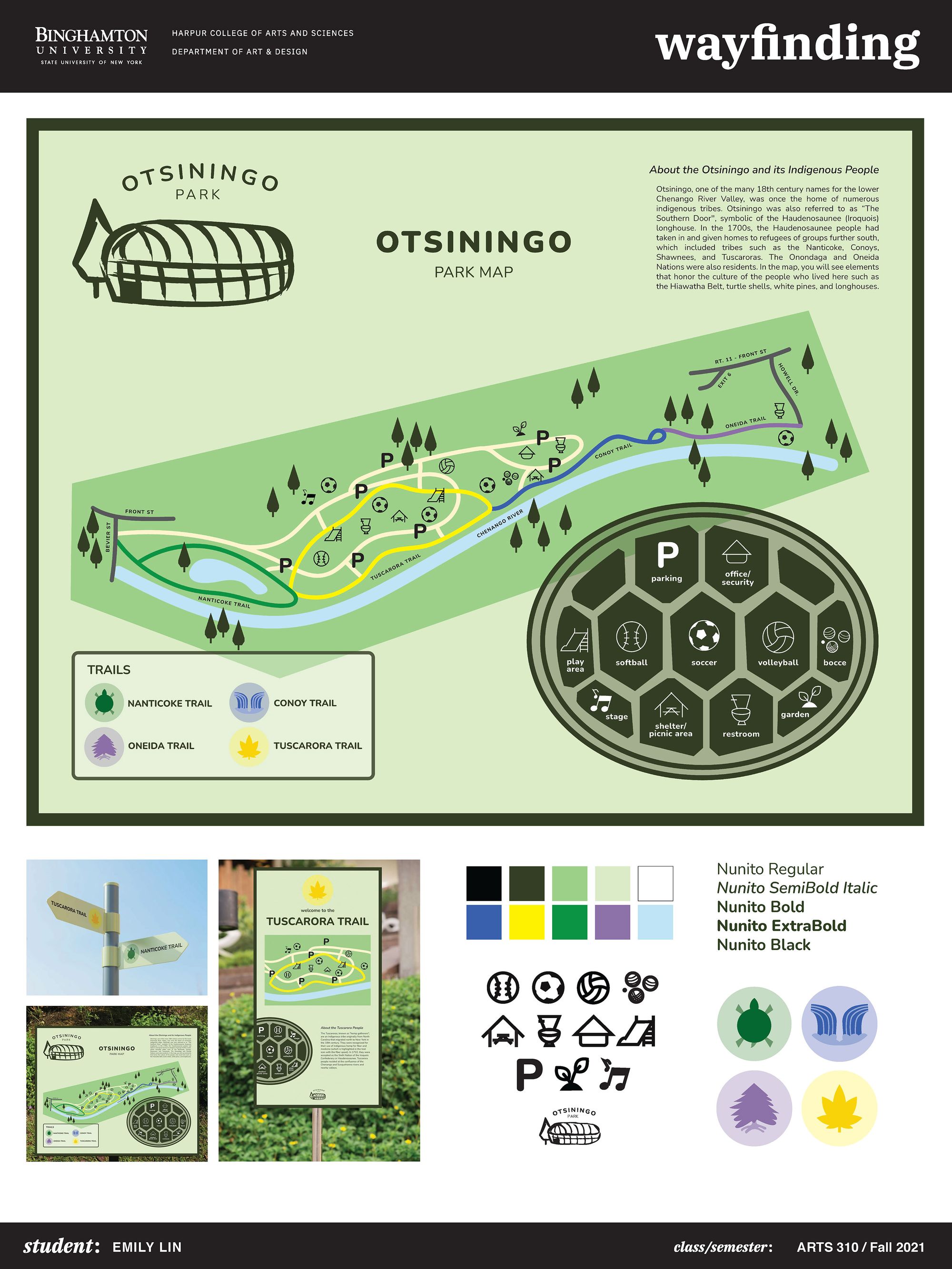
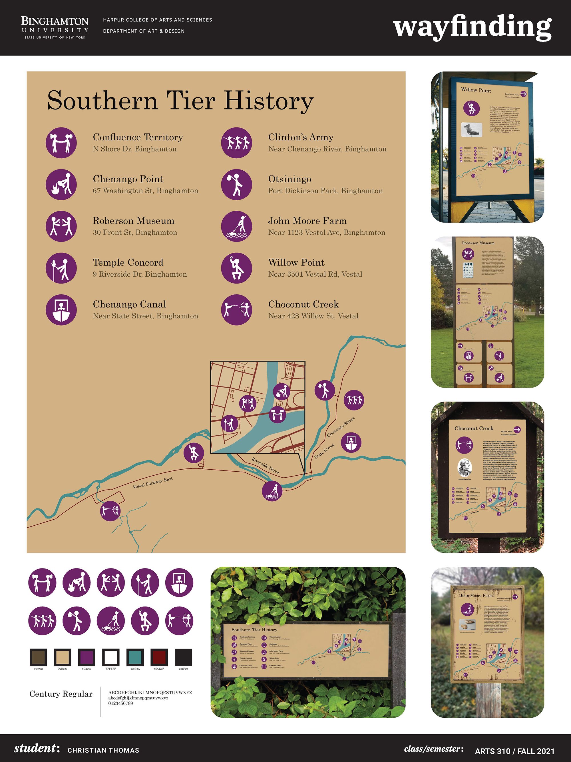
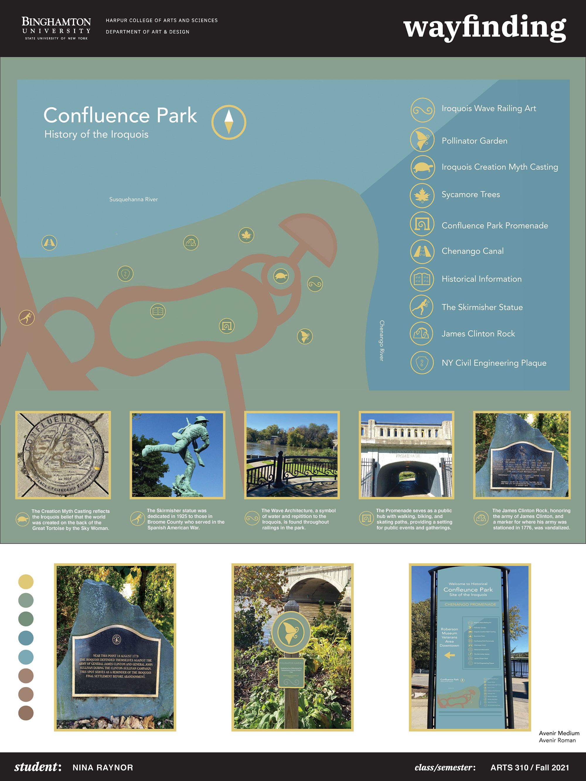
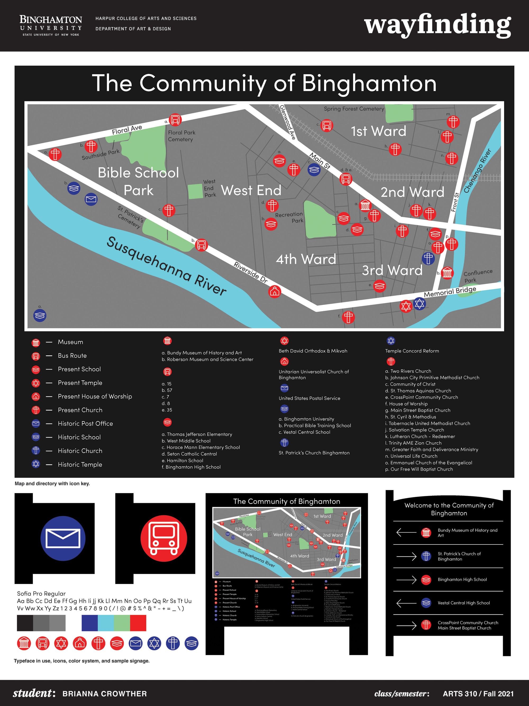
In the Fall 2021, the project ran in collaboration with Dr. Barry Brenton to work on the important historical area of the Confluence, where the Chenango and Susquehanna waters meet. For the occasion, I re-defined the exercise as a “re-wayfinding” project — to challenge students with a multi-dimensional map and a “wicked problem,” to enable people to experience the passing of time, but also to engage “users” into a conversation about a place over time. The re-discovery of historical heritage and other relevant information made up the stories students want to tell about this important space. Some students exhibited large format prototype posters at the event “A Confluence Convening” thank to the Binghamton University Art Museum. Here is a detail/component from one of the projects (the original monument and the re-wayfinding plaque). The outcome is also available in PDF.
The wayfinding or environmental graphic design discipline is intellectually engaging because at once it allows students to learn about the community and its institutions, meet interesting people, and use design to transform public spaces.
Material: Surveys, tracing paper, colored pencils, Illustrator, InDesign.